
Largest tributaries


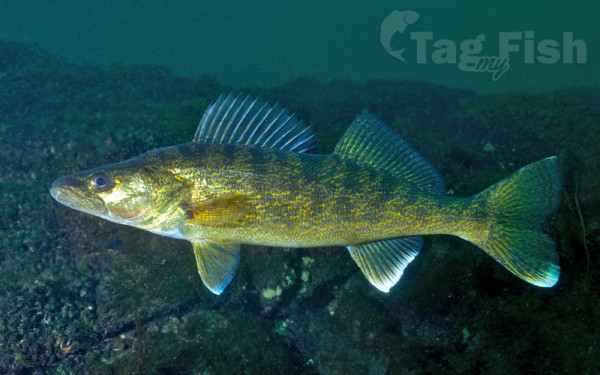
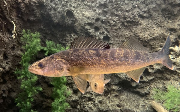
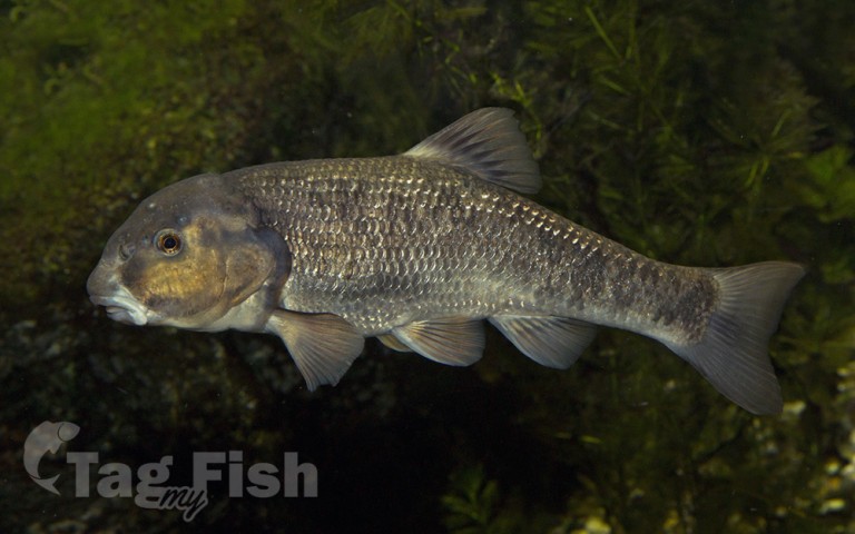
Perciformes - Perches
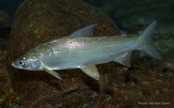
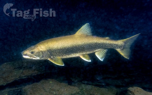
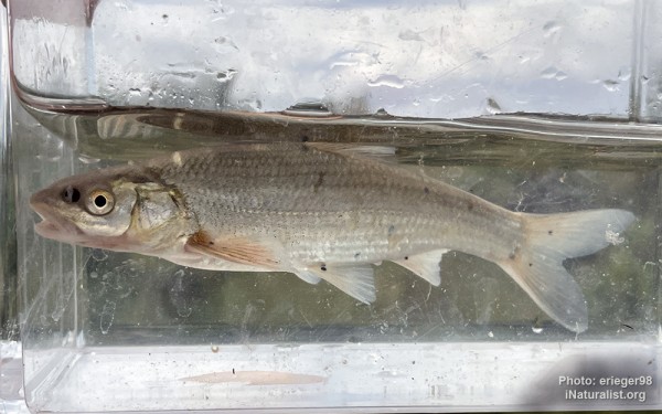
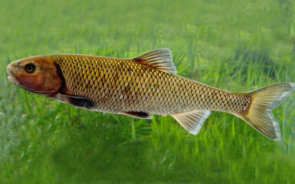
Salmoniformes - Salmons and Trouts
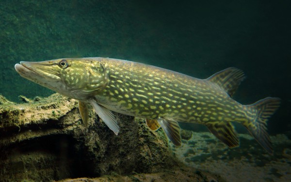
Esociformes - Pikes
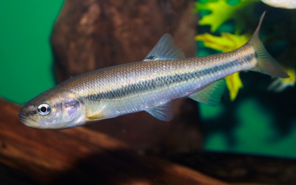
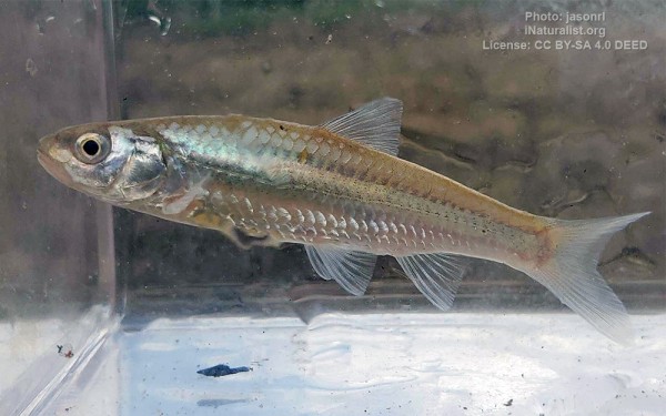
Cypriniformes - Carps
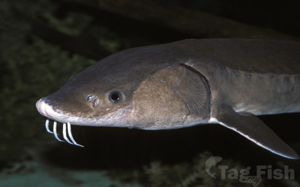
Acipenseriformes - Sturgeons and Paddlefish
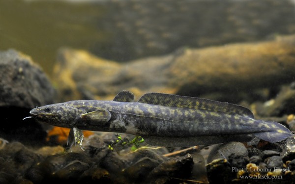
Gadiformes - Cods
Lake Winnipeg is a very large, relatively shallow 24,514-square-kilometre (9,465 sq mi) lake in North America, in the province of Manitoba, Canada. Its southern end is about 55 kilometres (34 mi) north of the city of Winnipeg. Lake Winnipeg is Canada’s sixth-largest freshwater lake and the third-largest freshwater lake contained entirely within Canada, but it is relatively shallow (mean depth of 12 m [39 ft]) excluding a narrow 36 m (118 ft) deep channel between the northern and southern basins. It is the eleventh-largest freshwater lake on Earth.
The lake’s east side has pristine boreal forests and rivers that were in 2018 inscribed as Pimachiowin Aki, a UNESCO World Heritage Site. The lake is 416 km (258 mi) from north to south, with remote sandy beaches, large limestone cliffs, and many bat caves in some areas. Manitoba Hydro uses the lake as one of the largest reservoirs in the world. There are many islands, most of them undeveloped.
The Sagkeeng First Nation holds a reserve on Turtle Island, in the southern part of the lake. The Anishinaabe people have been in this area for hundreds of years.
Hydrography
Lake Winnipeg has the largest watershed of any lake in Canada, receiving water from four U.S. states: (North Dakota and Minnesota via tributaries of the Red River, South Dakota via rivers draining into Lake Traverse, and Montana via tributaries of the Oldman River) and four Canadian provinces (Alberta, Saskatchewan, Ontario and Manitoba). The lake’s watershed measures about 982,900 square kilometres (379,500 sq mi). Its drainage is about 40 times larger than its surface, a ratio bigger than any other large lake in the world.
Lake Winnipeg drains northward into the Nelson River at an average annual rate of 2,066 cubic metres per second (72,960 cu ft/s) and forms part of the Hudson Bay watershed, which is one of the largest drainage basins in the world. This watershed area was known as Rupert’s Land when the Hudson’s Bay Company was chartered in 1670.
Tributaries
The Saskatchewan River flows in from the west through Cedar Lake, the Red River (including Assiniboine River) flows in from the south, and the Winnipeg River (draining Lake of the Woods, Rainy River and Rainy Lake) enters from the southeast. The Dauphin River enters from the west, draining Lake Manitoba and Lake Winnipegosis. The Bloodvein River, Berens River, Poplar River and the Manigotagan River flow in from the eastern side of the lake which is within the Canadian Shield.
Other tributaries of Lake Winnipeg (clockwise from the south end) include; Meleb Drain (drainage canal), Drunken River, Icelandic River, Washow Bay Creek, Sugar Creek, Beaver Creek, Mill Creek, Moose Creek, Fisher River, Jackhead River, Kinwow Bay Creek, Jackpine Creek, Mantagao River, Solomons Creek, Jumping Creek, Warpath River, South Two Rivers, North Two Rivers, South Twin Creek, North Twin Creek, Saskachaywiak Creek, Eating Point Creek, Woody Point Creeks, Muskwa Creek, Buffalo Creek, Fiddler Creek, Sturgeon Creek, Hungry River, Cypress Creek, William River, Bélanger River, Mukutawa River, Crane Creek, Kapawekapuk Creek, Marchand Creek, Leaf River, Pigeon River, Taskapekawe Creek, Bradbury River, Petopeko Creek, Loon Creek, Sanders Creek, Rice River, Wanipigow River, Barrie Creek, Mutch Creek, Sandy River, Black River, Sandy Creek, Catfish Creek, Jackfish Creek, Marais Creek, Brokenhead River and Devils Creek.


